Background
If you find this free trail guide useful, please provide payment by picking up at least one piece of litter on your hike. Cha-ching! Thanks for being awesome! (And here’s a quick primer on Leave No Trace, too, to help us keep the trails nice and fresh for each other.)
Background you can feel free to skip: “Whoa, whoa, whoa. Did you just say ‘tower’?” I asked a co-worker when he casually mentioned Red Hill fire tower. I’d never heard of the hill or the tower.
“Yeah, it’s nice little climb with a great view,” he said.
“Thanks for cluing me in! I’ll visit it soon!” I said. Then two years passed.
Turns out, the reason I’d never heard of Red Hill fire tower is that it’s on the far western edge of what I’d consider day-hikeable range from the Poughkeepsie area. With so many awesome hikes closer to home, Red Hill took a while to bubble to the top of the list.
One fine October Sunday, though, we were looking for a relatively short hike to take with some family friends.
“You guys mind a long drive to what is supposed to be an awesome hike?” I asked.
“We’re not scared of a little drive,” they replied. Game on!
And what a great game it turned out to be.
Besides the long trek out there (which could be short, you know, if you live near there), there’s really nothing NOT to like about this hike.

The walk to Red Hill fire tower features some steep sections (you gain approx. 837 vertical feet along the way), but nothing resembling a rock scramble. It’s just a beautiful uphill stroll that ends before anybody can whine too much.
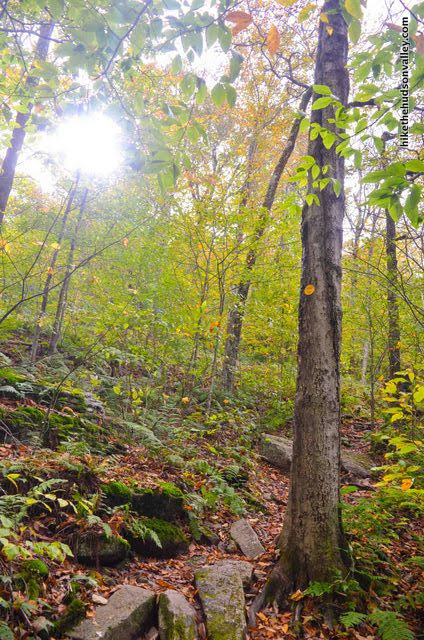
The trail is well-marked and well-maintained, heading through pristine woods the entire way.

The tower stands above a nice little meadow, and it offers views of pretty much everything.
“The only drawback might be the crowds. I don’t know how crowded this place gets, but an October Sunday is going to be its maximum craziness,” I predicted.
When we rolled up to the parking lot at around 10am on Sunday, Oct 14, though, we were the only car there. We had the tower to ourselves for about thirty minutes, too, before some other friendly hikers wandered up.
On our way back down, we passed a couple groups of hikers, but nowhere near the leaf-peeping hordes that I was expecting. When we got back to the small parking area, it had mostly filled up, but there were still some spots remaining.
I suspect we just got lucky to experience that kind of solitude, but perhaps there weren’t as many people there because we visited on the first weekend in the fall that the tower’s cabin was closed (the view is still wonderful from the platform just below the cabin). During peak season weekends, super-awesome volunteers open the cabins of the Catskill fire towers. From the Catskill Conservation Corps website:
“Volunteers work in pairs to meet and greet visitors and answer their questions about the towers, the Catskill Mountains, and related topics. Each volunteer works a minimum of three weekend days, plus a day or two of on-site training, during a season that runs from Memorial Day through Columbus Day.”
Thank you so much to all of the volunteers who donate their time to help the rest of us have great experiences out there! You all must be very cool people.
And this is a very cool hike! If you’re looking for a beautiful, brief hike in the Catskills, you’d have a hard time making a better choice than Red Hill fire tower.
(And special thanks to the Jee family for donating a couple of intrepid explorers to check this place out with us! Let’s do it again sometime.)
Trail Guide
Bonus unsolicited advice: Don't depend on having cell service in the woods - it can be spotty out there! Download this trail guide to your phone before you head out. (It's easy to do on iPhone and Android.) May your connection to nature be strong, even when your connection to the internet is weak.
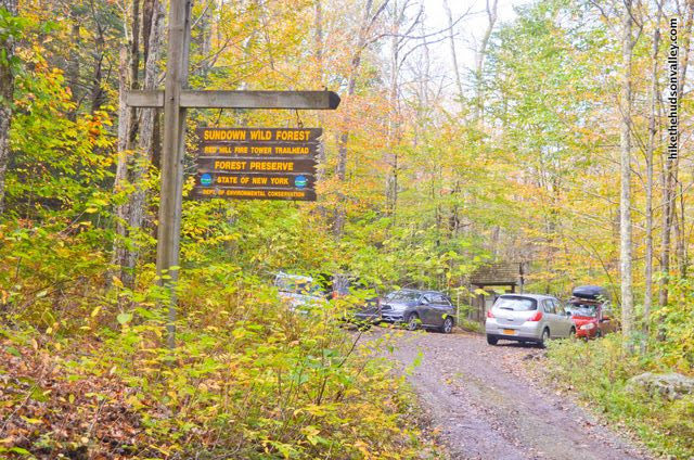
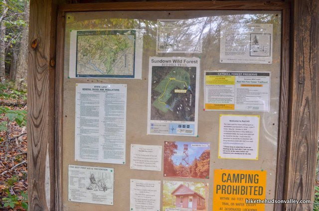
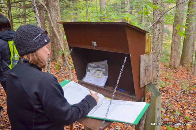
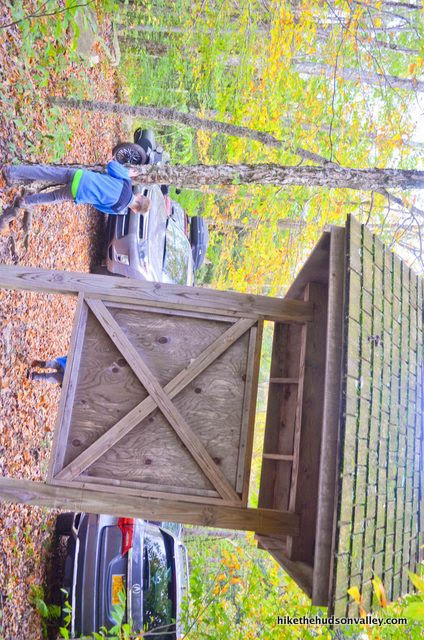
1. From the parking lot (see “Directions to the trailhead” below), head over to the kiosk and check out the posted information and maps. Might as well learn something while we’re here.
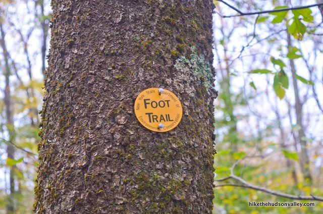
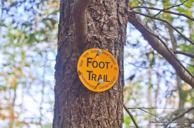
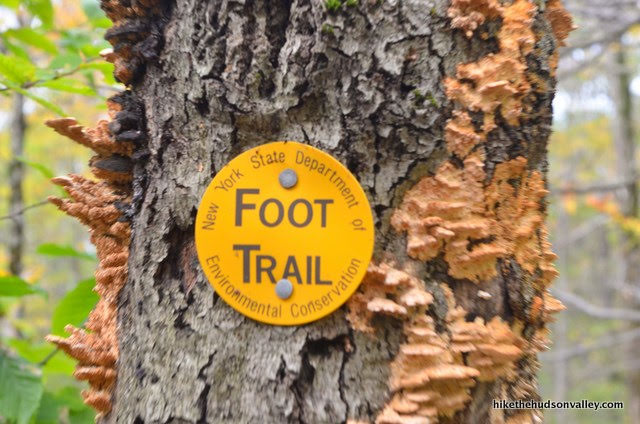
2. Just behind the kiosk, you’ll pick up the blazes and sign for the Yellow Trail, which will take you all the way to the fire tower.
The sign says it’ll be 1.4 miles to the top, which matches exactly what my GPS said. It’s all uphill from here, to the tune of about 837 vertical feet.

You also don’t really need me anymore, since those yellow blazes tell you everything you need to know to get to the tower. But since we’re both here, I’ll keep writing the trail guide anyway. It’s okay if you stop reading, though. I won’t be offended.
3. You’re still reading? Why? I mean, awesome!! Can you believe some people stopped? I’m totally offended. But joke’s on them – they’re going the wrong way! No, just kidding, there’s only one way to go from here, but I do appreciate that you’re still reading. Your parent(s)/guardian(s) clearly raised you right.
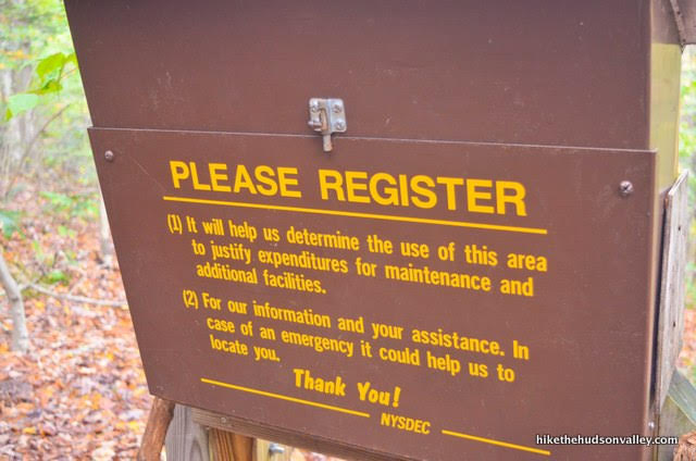
Just a moment after the kiosk, you’ll arrive at the trail register. Take a minute to sign in and let the good folks who manage this land know that you stopped by.
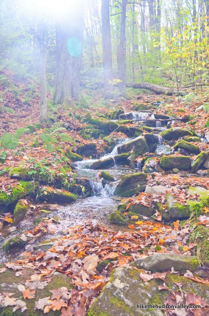
4. Just a minute after the trail register, you’ll come to a (seasonal?) stream crossing. We’d just had a TON of rain in the Hudson Valley prior to our visit, so I was a little concerned that the creek might not be passable.
No need to be worried, though. Just an easy hop-and-a-skip across.
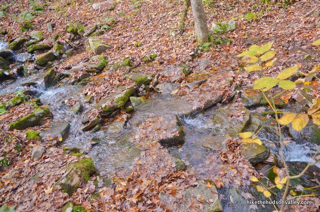
I suppose it’s possible that the crossing could get interesting in the spring, if there’s a huge snowmelt coupled with torrential downpours, but under pretty much any other circumstance, you shouldn’t have any problems here.
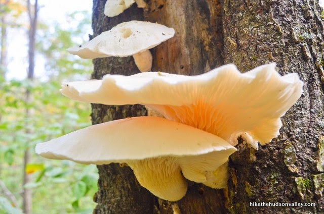
5. Shortly after the stream crossing, you may notice some numbers posted on the trees, corresponding to what we must assume is some awesome educational information somewhere.
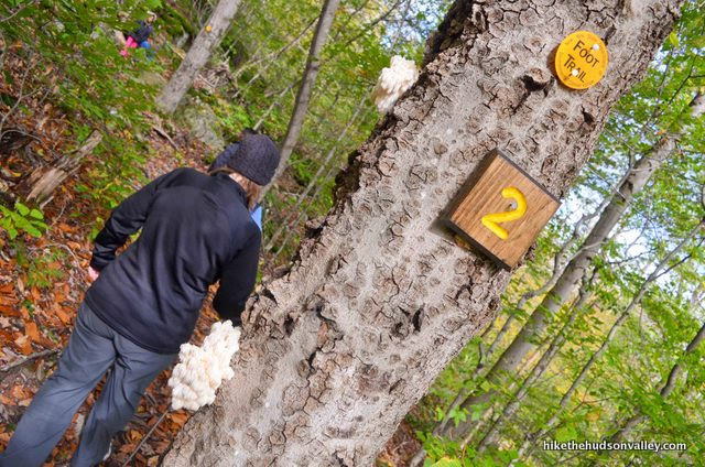
On the day we visited, right beneath the number 2, we saw perhaps my favorite fungus of all time.
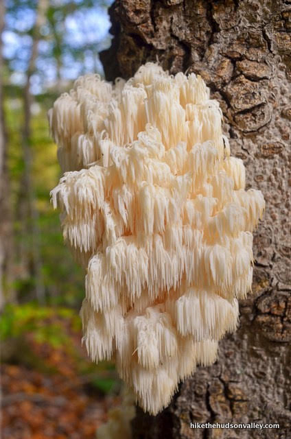
I shared the above picture on Facebook, identifying it as a lion’s mane mushroom. Astute Facebooker Tim Jackson said that it was actually a bear’s head tooth mushroom, which a quick Google image search suggests is probably correct. Thanks, Tim! Also educational for me: The fact that some people think this thing looks delicious. Comments included: “It’s so delicious!” and “They are quite tasty too.” People are interesting, right?
If you’re really hungry and you stumble across one of these mushrooms, I highly recommend that you eat a granola bar. Perhaps this mushroom actually is delicious, but unless you’re hiking with a mycologist, eating wild mushrooms can be a great way to kick off of a very memorable medical event.
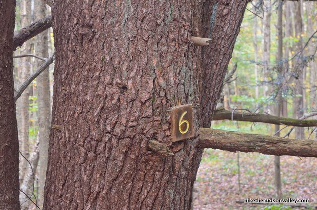
6. A few minutes after the number 2, you may notice the number 3, which marks a tree of some sort. If you’d like to know what kind of tree, you’ll have to upgrade your free account to Hike the Hudson Valley Premium. (Just kidding! That doesn’t exist. But you will have to consult someone smarter than me.)

About ten minutes after the number 3, look, the number 6! This must be a different kind of tree. (Also, if you noticed the numbers 4 or 5, you did better than me.)
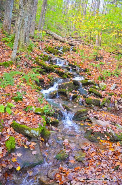
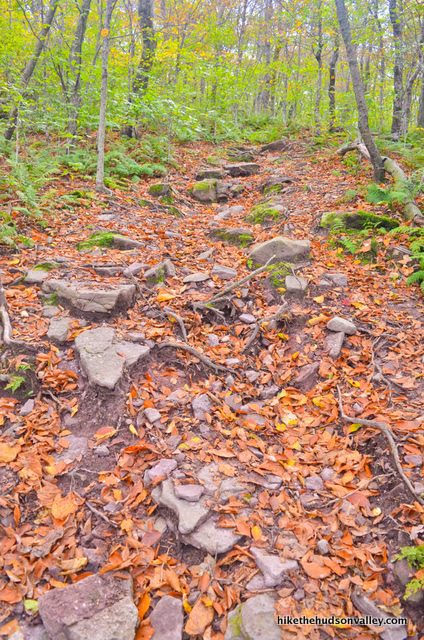
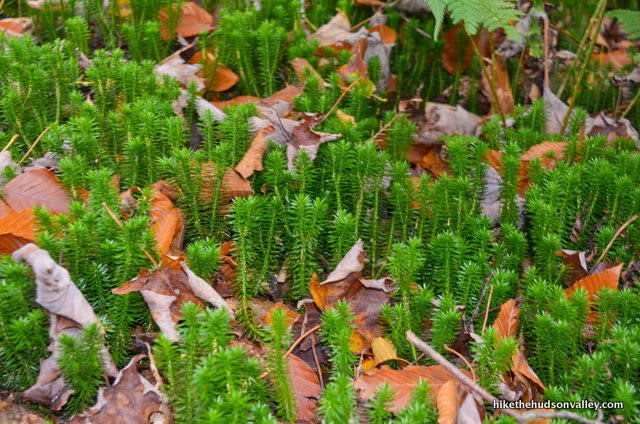
Whether you notice the numbers or not, you’ll surely notice that you’re walking through some beautiful woods right now. Sure beats whatever else you should be doing right now, right?
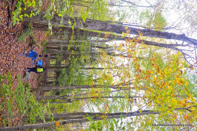

7. Huff-and-puff your way up the hill – from the parking lot, it took us about 45 minutes to reach the well-marked junction with a spring trail that breaks off to the right.
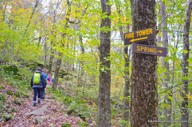
At this junction, you’ve climbed approximately 564 feet and completed 1.08 miles of your trek. Just another .3 miles and 250 vertical feet to the summit. Let’s do this!
Follow the “FIRE TOWER” sign to the left and keep on chugging.
8. Just after the spring junction, follow the “TRAIL” sign’s advice to stay on the trail. That sign has personality, right?

Just keep following the yellow blazes and gaining altitude.
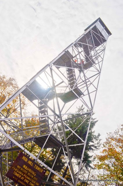
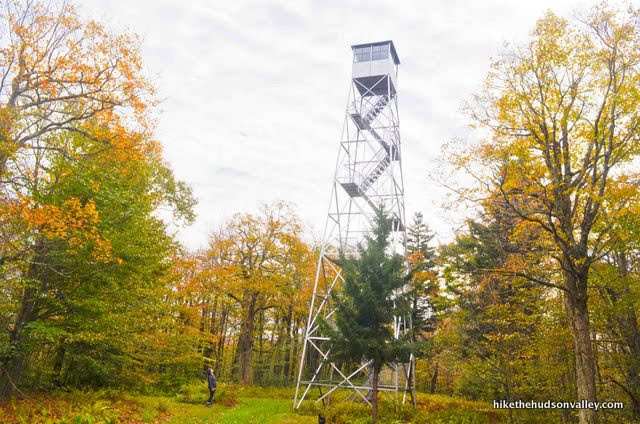
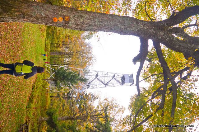
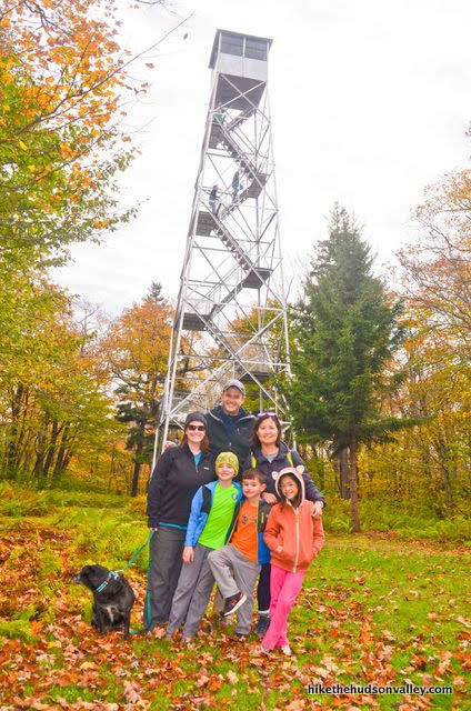
9. About ten minutes after the spring junction, the trail brings you to the ranger cabin. You made it!
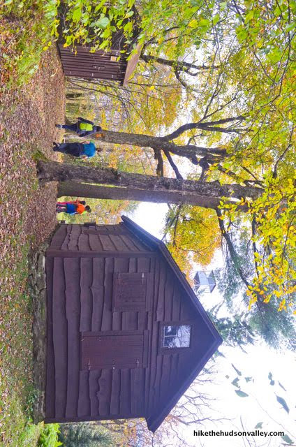
Straight across the clearing, there’s what you came for. Sixty feet of fire-towery goodness.
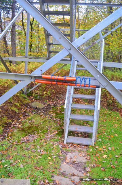
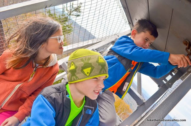
10. Head on over to the tower, taking note of the six-person limit.
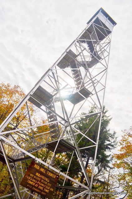

Watch your noggin on that first crossbar! (Someone helpfully attached some padding to it, so you’d have to bring some serious cranial velocity to hurt yourself. Thanks, whoever did that. Nice touch!)
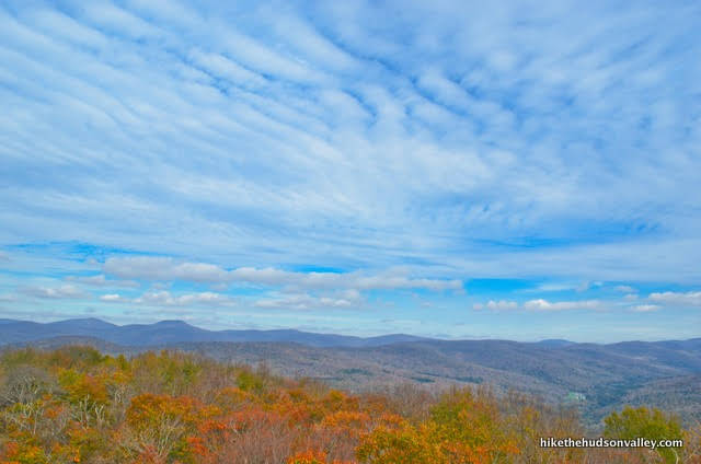
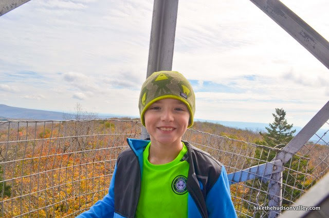
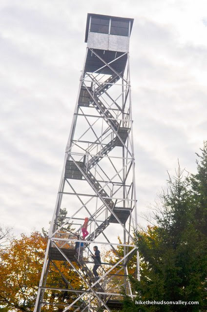
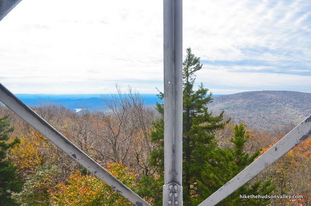
11. As you ascend the tower, the views begin to open all around you.
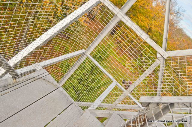
There’s even some fencing to keep your stuff and/or kids from falling off the edges. Another nice touch!
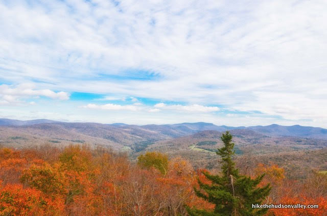
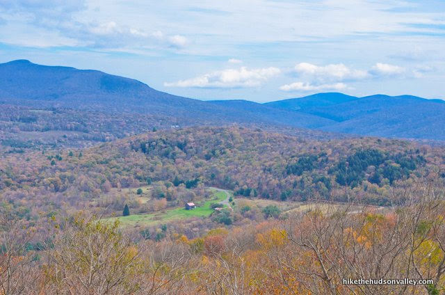
And finally, you emerge above the treetops. From the top of the tower, you get wonderful views in all directions.

When I say, “the top of the tower,” in our case, I actually mean “just below the top of the tower.” We had a pesky padlock impeding our way into the cabin.
The kids got over it pretty quickly. The view is great from the platform immediately below the cabin, and a few more vertical feet probably wouldn’t make too much difference. Plus, we chose to visit on the first weekend after the cabin was closed for the season, so it’s tough to blame the padlock for that one.
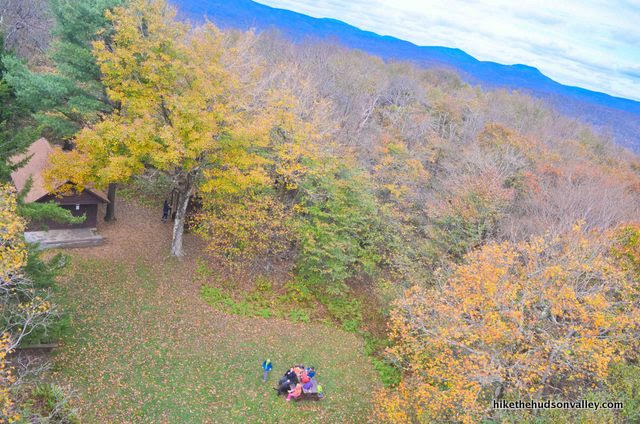
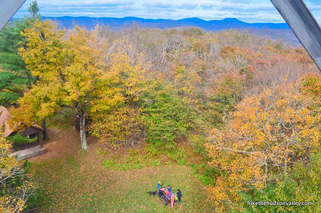
From that platform, you also get a nice vantage point looking down at the ranger’s cabin and picnic area immediately below the tower. Hey down there, everybody! Don’t eat our Cheez-Its!
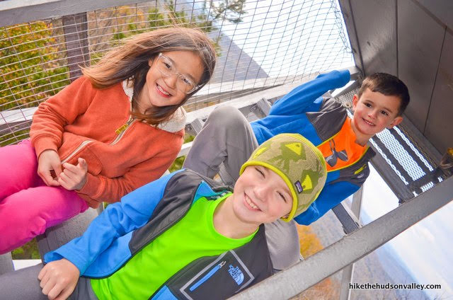
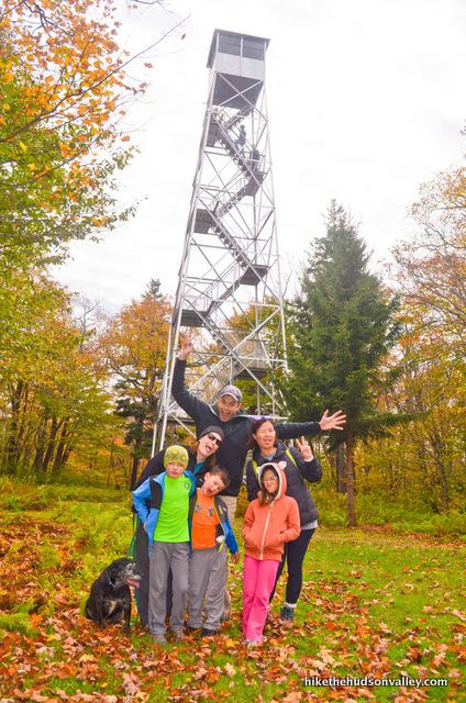
12. When you’re done enjoying the view from the tower, head back down and set up your tripod for a group shot.
Now the crazy one!
Once the crazy shot is recorded, prepare to retrace your steps all the way back to your car. Before you go, though, take a peek inside the outhouse (knock first!).
Notice the fine details: the covered toilet paper can, the air freshener, the paint job, the window, the hand sanitizer pump, the framed artwork on the wall(!). Is that a motion-sensor light on the ceiling? Jersey Turnpike rest areas could learn a thing or two from this outhouse.
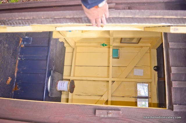
To the person or people who maintain this outhouse, you deserve a medal: The Nature Calls Medal for Outstanding Outhouse Upkeep. The is the finest outhouse I have ever seen. Plumbing? Who needs plumbing?
When you’re done ogling the outhouse, you can check out the posted information on the ranger’s cabin from the Red Hill Fire Tower Committee, with emergency numbers and other good info (including how to sign up to volunteer!).
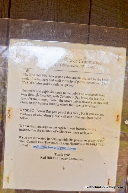
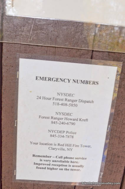
From everything I can tell up here, the Red Hill Fire Tower Committee sure does an amazing job. Thanks for the awesome tower, you guys!
13. Tower? Check. Outhouse? Check. Crazy shot? Check. Cheez-Its? Check. That’s everything – time to head back home! Return past the ranger’s cabin to pick up the Yellow Trail again and head downhill.
You may notice some more cool natural goodness along the way.
Otherwise, just keep on chugging! It took us eleven minutes to get back to the spring junction.

And another forty minutes back to the stream crossing.
From there, you’re just a hop-and-a-skip from the trailhead.
That’s it! Hope you enjoyed your visit to Red Hill fire tower. Great place, right? Time to return to civilization and see if we can find some pizza there. But not indoor plumbing! That’s obsolete now.
Directions
Directions to the trailhead: I highly recommend that you use your favorite GPS device to navigate this drive, but I’ll take a crack at providing some old-school written directions here in case it’s helpful. From the intersection of Routes 44 and 209 in the village of Kerhonkson, take 209 West (also marked as Route 55). After 3.5 miles, turn/veer right onto Old Route 209. In .3 miles, turn right onto Continental Rd. In 1.3 miles, Continental dead-ends into Route 55 (how did that happen?) – turn right here onto Route 55.
In 3.4 miles, turn/veer right onto Route 55A. Stay on 55A for 7.6 miles – pretty through here, right? When you reach the end of the Rondout Reservoir, 55A tees into 55A (I know, it looks like a typo, but it’s not) and Sundown Road. Turn right onto Sundown Road. In .2 miles, turn left onto Sugarloaf Road. Follow Sugarloaf Road for 4 miles, then turn left onto Dinch Road. In .5 miles, turn right to stay on Dinch Road, where Red Hill Road (don’t be lured!) goes straight/left. Continue on Dinch Road for .5 miles, then continue straight as Dinch Road decides to start calling itself Coons Road for some reason.
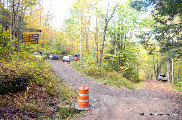
In a few more feet, Coons Road decides to start calling itself Old Dinch Road for some reason. (Seems like we could have just kept calling the whole thing Dinch Road and everyone would have been happy — with the possible exception of Old Man Coons — but maybe that’s me.) Continue slowly on the gravelly Old Dinch Road for .5 miles until the small, well-marked DEC parking lot on the left (it says SUNDOWN WILD FOREST at the top of the sign, and RED HILL FIRE TOWER TRAILHEAD underneath).
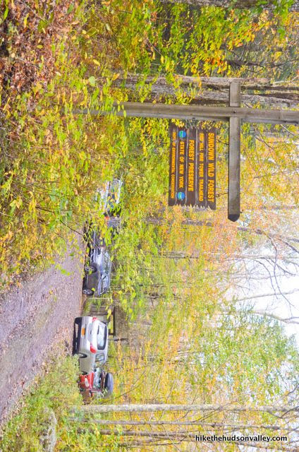
I’m not 100% on the legality of parking along Old Dinch Road if the lot is full (please be considerate and follow any posted directions you may find here, though I didn’t see any), but at least on the day we visited, it looks like there is some precedent (and room) for doing so.
Grab a spot, pull in, climb out, and let the adventure begin!

You can also get directions by checking out the Red Hill fire tower entry on the HiketheHudsonValley.com Google map.
Sorta nearby address for your GPS: Just plopping “Red Hill Fire Tower DEC Parking” into Google Maps will take you to the right place. Otherwise, you can use the address of the nearby Blue Horizon Bed & Breakfast:
60 Dinch Rd
Claryville, NY 12725
From there, just keep heading straight on Dinch Road as it becomes Coons Rd/Old Dinch Rd, and you’ll be to the parking area in .7 miles.
GPS coordinates of parking area: 41.9298, -74.50703 (Clicking will open in Google Maps or the Apple Maps app, depending on your browser/device.)
Resources & Interactives
Super-cool Google Earth flyover of hike route:
Google Terrain Map of hike route:
Related resources: If you’re looking for actual facts and/or useful information, visit these resources:
- The official (and free!) Red Hill fire tower trail map from the NY-NJ Trail Conference
- Some nice information on all the Catskill fire towers on the Catskill Center’s Catskill Fire Towers page
- A nice (and more concise, if you’re into the whole brevity thing) write-up on the same hike detailed above on CatskillMountaineer.com
- Some nice info on the tower from the Town of Neversink’s Red Hill Fire Tower page
Want to support trails in the Hudson Valley? Here’s one great way: Visit the New York-New Jersey Trail Conference homepage and click on Volunteer, Donate, or Shop! (Then you can volunteer, donate, or shop, depending on your mood.)
Your guides are always incredibly useful— thank you so much for making hiking in the region easily accessible! Actually hiked this one from the Denning Road trailhead, which is about a 4 mile round trip with a bit more elevation gain, but overall still a moderate, family friendly hike. The lot at that trailhead has been redone recently and might provide a bit more parking now than the Old Dinch Road lot (https://www.dec.ny.gov/press/122341.html has some details). Fire tower was great and the steward was quite friendly and informative.
JB — Thanks so much! And thank YOU for the great info! I had no idea about the new parking area and trail, and the link you provided is really useful. Thanks for clueing me in! I’ll have to drag the family back here to check it out. Really appreciate the update and kind words!
As always, thank you for the thorough instructions! We did the hike yesterday, but I have to say my kids had mixed feelings, especially at the last 250ft. Did not look as happy as your little explorers! But we did it and I really enjoyed the hike and the views on top. The trail and hiking with trees all around us was amazing. We are now in April and the stream was easy to cross. Just to note, before we reached the Red Hill Fire Tower DEC Parking there was a barrier on the left of the road, a sign that the road had hazardous conditions and 3 cars were parked on the left of the road in a small area that did not fit any more cars. It looked prohibitive but we trusted your directions and the fact that the road looked pretty dry and we moved on until we saw the signs for the parking on the left and a few cars were parked there as well.
Thanks so much, Ermina! And don’t worry if your kids didn’t look as happy as ours — we also experienced plenty of whining. My kids usually start whining before we lose sight of the car. But I think they come around once I remind them of how much character they’re building! Or maybe it’s the Cheez-Its.
As a local, I have to say I love this write up! Thanks!! Your directions are awesome.
Thank you so much, Allison!
Hi ! planning to go tomorrow here. Not sure if it will be open all the way to top or not. anyone?
Hi, James! The season runs from Memorial Day through Columbus Day for volunteers to open the cabins in the Catskill fire towers, so barring some crazy good fortune, I believe you will find the same padlock we found up there. It’s still a great view even when you can’t get into the cabin — have a great day out there tomorrow!
It was locked but what a view 0_O !! I could see so many mountains unlike from Mt. Beacon tower.
Hike distance was perfect as we had someone with us who never hiked before but that drive x_x i drove back and forth. That’s the furthest hike from me i think. Driving exhausted me but it was all worth it. My friends got little scared as there was no sign of anyone. No cars, no noises and no wind. It was complete silence just as i like it. It became more windy up there.
I would like to thank you very much, Mike for putting all these guides out there. Just because of this detailed guide, i decided this hike because it covered all my concerns. It was far but so worth it.
When i search your website with key word fire tower because i love something to look forward to once at the top and it pulled 8 hikes with fire tower. We already been to Mt. Beacon and we finished Red hill yesterday. We are planning for Hunter mountain next week x_x let’s see.
Thanks again !!
James, so glad to hear you and your crew had a great day out there (except for the drive, which is indeed a killer, but a pretty killer!). Thanks so much for the kind words, and good luck tackling Hunter!